Your source for natural, travel, and cultural Art, Photography, Video, and Media ...
County Kerry
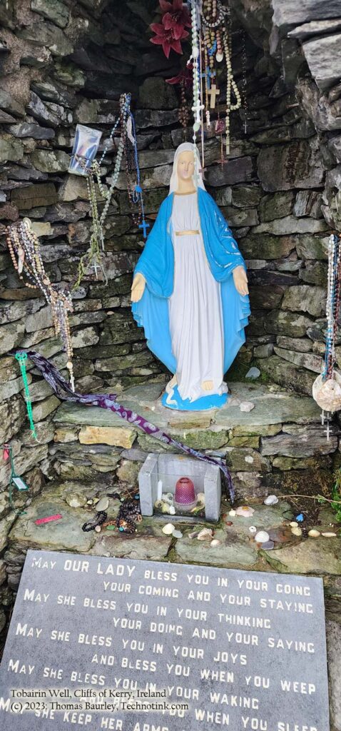
The Tobairin Well, along the Skellig ring, Wednesday, 20 December 2023. Adventures in County Kerry, Ireland. Photos by Thomas Baurley, Techno Tink Media.
Tobairin Holy Well Coomanaspig, near the Cliffs of Kerry, County Kerry, Ireland Just past the parking area of the Cliffs of Kerry, up the hill, along the Ring of Kerry,…
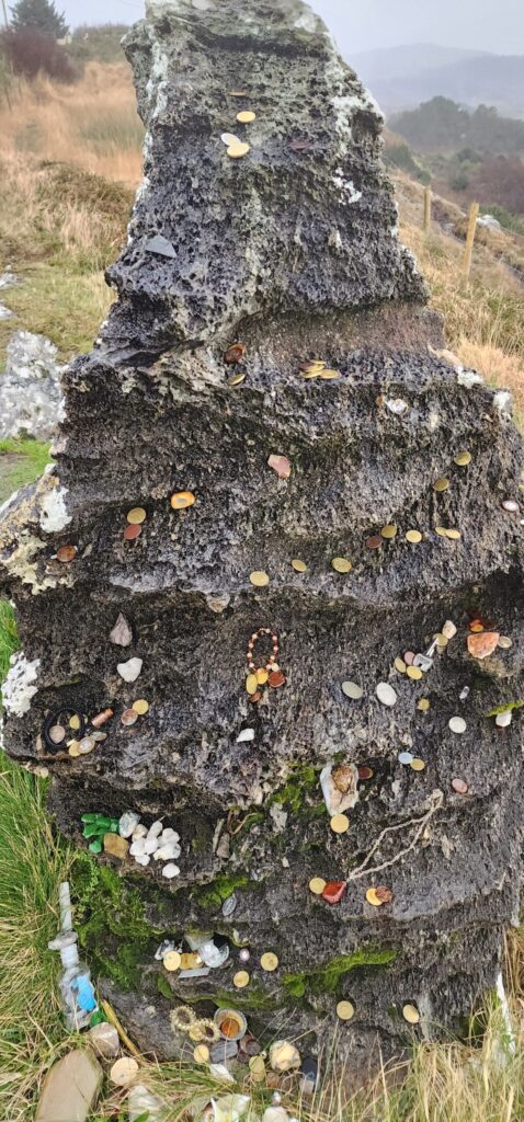
Cailleach Bherra, Hag of Beara, stone ritual site, ring of Beara, county Kerry, Ireland. Tuesday, 19 December 2023. Adventures in County Kerry, Ireland. Photos by Thomas Baurley, Techno Tink Media.
[ngg src="galleries" ids="100" display="masonry" animate_images_enable="0" animate_images_style="wobble" animate_images_duration="1500" animate_images_delay="250" ngg_triggers_display="always"]The Hag of Beara Stone or An Chailleach Bhéara by Thomas Baurley, Folklorist and Archaeologist, Techno Tink, LLC https://technowanderer.com/hag-of-beara-stone/ https://archaeologyfinds.com/?p=305 https://technotink.net/lore/?p=4268 Ring…
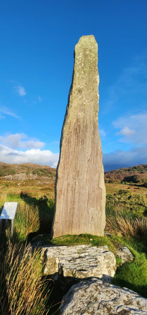
The Ogham Stone, ring of Beara, county Kerry, Ireland. Tuesday, 19 December 2023. Adventures in County Kerry, Ireland. Photos by Thomas Baurley, Techno Tink Media.
Ballycrovane Ogham Stone or Beara Ogham Stone (Béal A’Chorraigh Bháin) Co. Cork, Southern Ireland Irish grid ref: V 6569 5291 https://archaeologyfinds.com/?p=271 https://technotink.net/lore/?p=4234 At this point in my journey, I was…
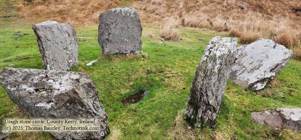
The Uragh Stone Circle, Ring of Kerry, Kerry County, Ireland. Tuesday, 19 December 2023. Adventures in County Kerry, Ireland. Photos by Thomas Baurley, Techno Tink Media.
URAGH STONE CIRCLE GPS: 51.81157, -9.69532 Coordinates: 51°48′42.23″N 9°41′37.74″W Map Ref: V8311763439 Discovery Map Number: D84 Latitude: 51.811550N Longitude: 9.695514W near Gleninchaquin Park, Beara Peninsula, County Kerry, Ireland While driving…
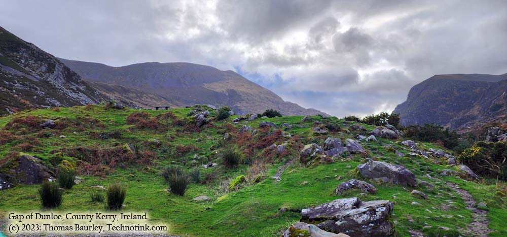
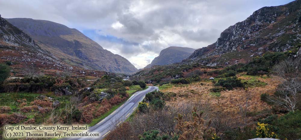
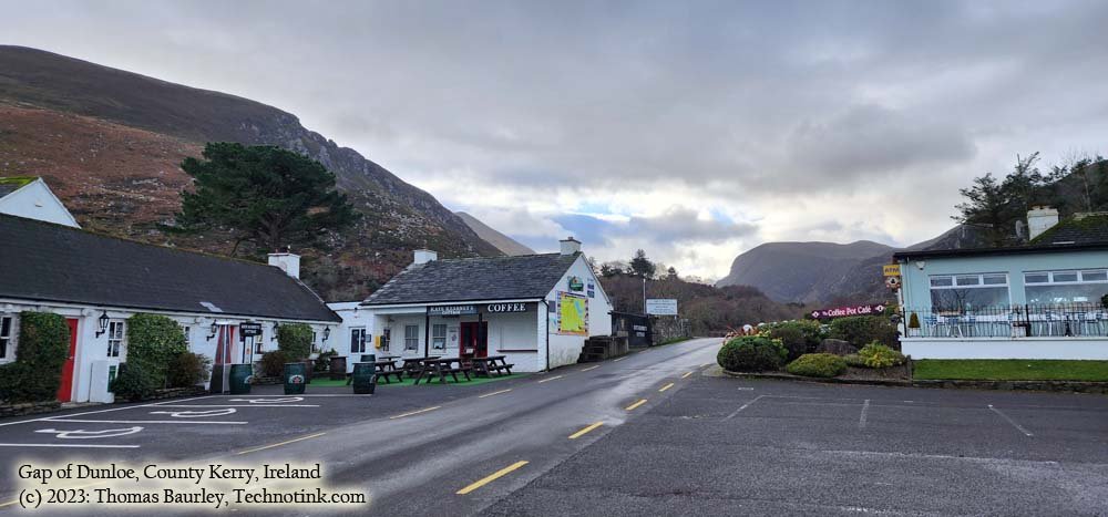
The Gap of Dunloe, Ring of Kerry, Kerry county, Ireland. Tuesday, 19 December 2023. Adventures in County Kerry, Ireland. Photos by Thomas Baurley, Techno Tink Media.
GAP OF DUNLOE, County Kerry, Ireland
[ngg src=”galleries” ids=”97″ display=”slideshow”]
Gap of Dunloe, County Kerry, IrelandMarch 28, 2024, by Thomas Baurley
While driving the scenic tour called the “Ring of Kerry,” I gave the infamous “Gap of Dunloe” a gander. Named after the River Loe that runs through it, the “Gap of Dunloe” is derived from the Irish “Dún Lóich,” meaning ‘Lóich’s stronghold’ or “gap of the little hollow.” Glaciers forged this narrow mountain pass during the last ice age 25,000 years ago. It is quite a stunning off-the-beaten-trail trek. It was created from the Purple Mountain and MacGillycuddy Reeks glacial flows. Geologically, the pass is north-south oriented between the Old Red Sandstone mountain ranges of the MacGillycuddy’s Reeks on the west and the Purple Mountain Group on the east. The highest point is at the Head of the Gap at 241 meters.
Within is Loe River cutting the gap, which is part of its namesake. Starting at Kate Kearney’s Cottage, one takes a seemingly one-lane narrow golf-cart-sized road (two-way traffic with little to no pullovers to let people pass) and descends into the mysterious “Black Valley.” One can see five lakes along the route—Coosaun Lough, Black Lake, Cushnavalley Lake, Auger Lake, and the Black Lough.
The trek is not advisable by auto during tourism, but one can get away with it like I did during the winter/off-season months. Most hike or walk up the road from Kate Kearney’s cottage to the old “Wishing Bridge.” The road runs approximately 11 km from north to south. Some hire a horse-drawn wagon to go through the pass and return via a boat back to Killarney from Lord Brandon’s cottage at the other end. Others take the grueling bicycle run that’ll take in your day.
It is said that the first leader of the Fir Bolg, known as “Loich,” had his stronghold here, According to the Annals of Clonmacnois, Keating, and the Lebor Gabála Érenn (LGE). Loich, or more appropriately… Deala (or Dela) Mac Lóich, was the father of the five chieftains of the returning Fir Bolg (Slainghe, Gann, Genann, Seangann, and Rudhraighe) who conquered Ireland before the Milesians and Tuatha de Danann arrived on the Isle. The Fir Bolg divided Ireland into five provinces, each ruled by one brother. This is estimated to have occurred for 37 years from 3266 – 3303 B.C.E. According to the Annals of the Four Masters. They lost their rule once defeated by the Tuatha Dé Danann.
Also of historical notoriety is Kate Kearney’s Cottage. An enchanting mixologist named Kate lived here from 1845 to 1849 and was well-reputed for her elixir-called poitin. While illegal, she made it and sold it to the travelers who ventured through the gap to give them the strength they needed to endure the journey.
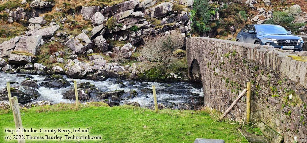
The Wishing Bridge is a historic stone bridge with picturesque scenery that attracts many tourists, offerings, and coins. It is said that any wishes requested at the bridge always come true.
The Wishing Bridge, The Gap of Dunloe, Ring of Kerry, Kerry County, Ireland. (more…)